Figure 1
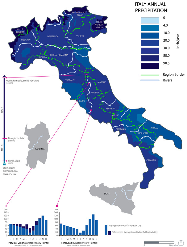
Figure 1 (Physical Region): Demonstration of Italy's annual precipitation rate and how many inches of rain each region receives a year. The map is clearly marked by regional borders and also includes river labels.
Figure 2
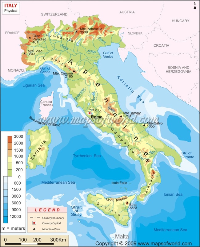
Figure 2 (Physical Region): A physical map of Italy that represents the different geographical features including sea levels that vary around the country.
Figure 3
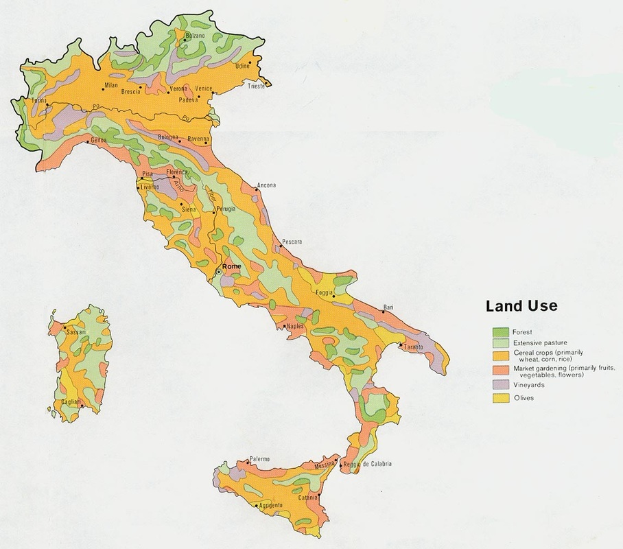
Figure 3 (Cultural Region): This map represents the variety of land use throughout Italy which outlines areas that strengthen in specific production.
Human Features

The ColosseumOne of Italy's most famous man-made landmarks, that was used for bloody games to represent strength and power.
|

Venice CanalsBoat rides through the canals of Venice in-between old buildings have been tradition for hundreds of years.
|

PompeiiThe remains of a small ancient Roman city that survived the eruption of Mt. Vesuvius.
|

Leaning Tower of PisaAnother famous landmark that was built in the 1100s and started to lean once workers reached the third story. Was predicted to fall by 2000, but still remains standing today.
|

Florence Duomo Santa Maria del FioreOne of the finest cathedrals in the world, which dominates the Florence skyline.
|
Physical Features
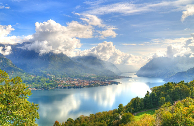
Lake ComoOne of Italy's most scenic areas that is surrounded by mountains and small towns.
|

Amalfi CoastA stunning stretch of coastline along the Sorrentine Peninsula.
|

Cinque TerreA beautiful coastal region with steep oceanside cliffs and hills.
|

Stromboli VolcanoOne of the three still active volcanoes in Italy that is located off the north coast of Sicily.
|

The AlpsThe Alps are mountains that separate Italy from France, Germany, Austria and Switzerland to the north.
|
